Heritage Trail
A Glance at Iron Counties Past and Present
A Self Guided Tour
Iron County, Michigan is set amid the scenic forests, lakes and streams of the State’s beautiful Upper Peninsula. No matter what time of year you choose to visit, an array of cultural and natural attractions await your discovery. These designated sites along the 36-mile route, some of which are on the National Historic Register, are clearly marked and numbered to correspond with those in this brochure. Along the way are many other historic and natural features to be enjoyed. The Friends of the Heritage Trail, a non-profit organization, coordinates site maintenance and development.
Heritage Trail Sites:
Here are the 14 sites to visit along this trail:
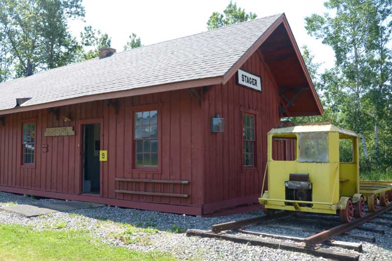
1) Iron County Heritage Museum
The 10-acre grounds contain six complexes – logging, homesteading, mining, transportation, Victorian and the arts with 26 buildings.
Location: Drive two miles South of Iron River on M-189; turn E on 424 to Caspian, then left to Museum Road.
Phone: (906) 265-2617
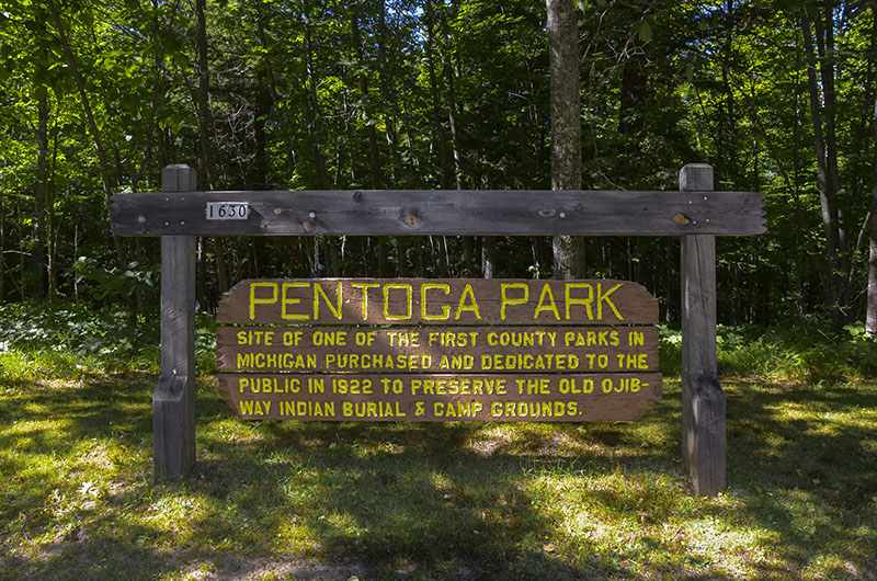
2) Pentoga Park Indian Burial Grounds
This is the site of a pre-European Native American settlement and permanent area headquarters where Ojibwa Bands congregated.
Location: County Road 424 at South end of Chicaugon Lake.
Phone: (906) 265-3979
3) Alpha Circle Historic District
Established in 1914, this example of early engineering and government planning showcases a traffic circle.
Location: County Road 424, center of Village of Alpha.
Phone: (906) 875-3465
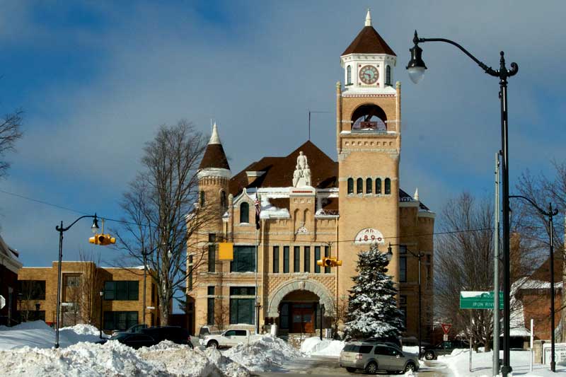
4) Iron County Courthouse
Located in the Crystal Falls Historic District, it is the most architecturally significant building in the County.
Location: 2 South Sixth Street, at the top of the hill in Crystal Falls.
Phone: (906) 875-3301
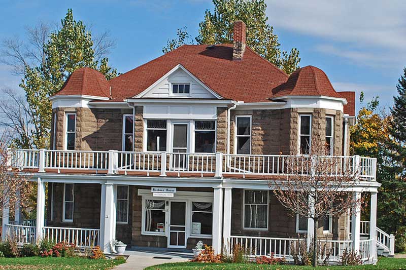
5) Harbour House Museum
Originally built in 1900, this Queen Anne Colonial Revival home has been restored and is now a museum featuring furnishings, decorations and artifacts from Iron County’s past.
Location: 17 North 4th Street in Crystal Falls.
Phone: (906) 875-4341 or (906) 875-3454
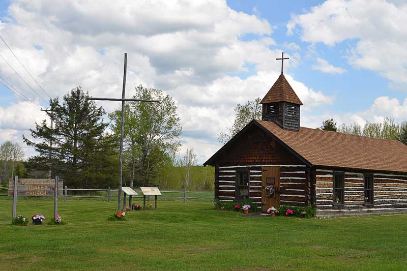
6) Mansfield Location & Pioneer Church
Mansfield is the site where one of Michigan’s worst mining disasters occurred on September 28, 1893; 27 miners lost their lives in a cave-in.
Location: Seven miles North of M-69 on Mansfield Cutoff Road, 1mile North on Stream Road.
Phone: (906) 875-3553
7) Amasa Museum
The Amasa Museum, located in the Main Street Historical District of Amasa, formerly the township hall, is a fine example of late 1800s balloon–style architecture.
Location: 12 miles North of US 2, just off Hwy 141 on Pine Street in Amasa.
Phone: (906) 265-2617
8) Fortune Pond
Fortune Pond is an example of how mine sites can be reclaimed by nature. This iron mine produced 1,316,905 tons of iron ore from 1953 to 1958.
Location: ¾ mile North of US 2 on New Bristol Rd, two miles West of Crystal Falls.
Phone: (906) 265-3822
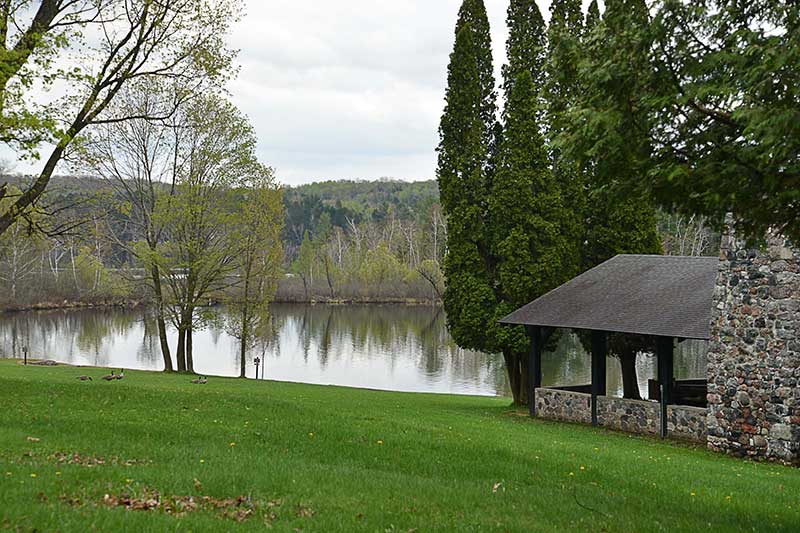
9) Be-Wa-Bic (Bewabic) State Park
This 315-acre State Park has a number of public log buildings built by the Civilian Conservation Corps (CCC) in the 1930s.
Location: Four miles West of Crystal Falls on US 2.
Phone: (906) 875-3324
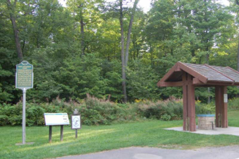
10) Larson Park
Established in 1919, this park is the first roadside picnic site in Michigan and perhaps in the entire United States.
Location: On US 2, four miles East of Iron River.
Phone: (906) 875-3301
11) Apple Blossom Trail
This paved non-motorized pathway along the banks of the Iron River was originally the major corridor for the rail lines that hauled thousands of tons of iron ore.
Location: Trailhead located at the Iron County Chamber of Commerce; Access points in downtown Iron River or Caspian.
Phone: (906) 265-2514 (Caspian City Hall)
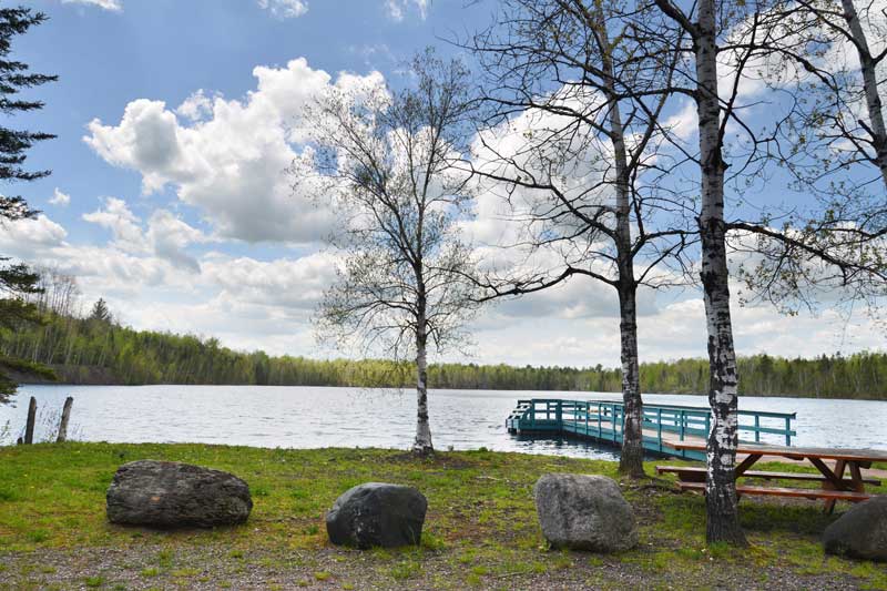
12) Lake Ottawa Recreation Area & Campground
An Ottawa National Forest recreation site that offers hiking trails to Orville’s Bench on the Ge-Che trail. The site introduces visitors to one of the most breathtaking natural views in the County. Learn More.
Location: One mile South of US 2 on M-73 to Ottawa Lake Rd, four miles.
Phone: (906) 265-5139

13) Mile Post Zero & Treaty Tree
This site notes where Captain Thomas Cram placed the first marker at the survey point establishing the Wisconsin-Michigan state boundary in 1840.
Location: From M-73 continue on Ottawa Lake Road to West Brule Lake Road to Stateline Picnic Grounds, total seven miles.
Phone: (906) 265-5139

14) Camp Gibbs Recreation Area
In 1935, Camp Gibbs was established as a Civilian Conservation Corps (CCC) camp. The materials and methods of construction represent a time when frugality was critical to the survival of society.
Location: Ten miles North of US 2, about two miles West of Iron River.
Phone: (906) 265-5139
Select photos contributions by Kevin Zini, Nina Graff and Jill Koivunen